Arrival at Tribhuvan International Airport. Relax and explore Kathmandu’s vibrant culture. Enjoy a welcome dinner with Nepali cuisine.
Sleeping altitude: 1,400 m
The Manaslu Circuit Trek offers an unforgettable journey through some of Nepal’s most remote and unspoiled regions. This trek perfectly balances cultural immersion, natural beauty, and a challenging adventure, including crossing the famed Larkya La Pass (5,135m). It’s a journey into the heart of the Himalayas, featuring the mighty Mt. Manaslu (8,163m) and surrounding peaks.
Whether you're drawn by stunning mountain views, a culturally rich Tibetan-influenced trail, or the adventure of high-altitude trekking, the Manaslu Circuit is a must-visit.
15 days
Nepal
5,106 M
Spring and Autumn
Moderate
5-6 Hours
Contact us for private groups with custom itinerary and flexible dates.
Arrival at Tribhuvan International Airport. Relax and explore Kathmandu’s vibrant culture. Enjoy a welcome dinner with Nepali cuisine.
Sleeping altitude: 1,400 m
Scenic drive from Kathmandu through lush countryside and villages.
Distance: 150 km
Trek Duration: 7-8 hours
Sleeping altitude: 1,340 m
Trek along the Budhi Gandaki River, crossing suspension bridges and passing through Gurung villages and forests (19 km).
Distance: 19 km
Trek Duration: 6-7 hours
Sleeping altitude: 1,900 m
Pass through forests and small settlements, with your first views of the stunning Siringi Himal (18 km).
Distance: 18 km
Trek Duration: 7 hours
Sleeping altitude: 2,630 m
Enjoy incredible views of Ganesh Himal and Hiunchuli. Visit Ribung Gompa, a cultural highlight of the trek (10 km).
Distance: 10 km
Trek Duration: 6 hours
Sleeping altitude: 3,180 m
Trek through dense forests and picturesque villages, with breathtaking views of Mt. Manaslu (13 km).
Distance: 13 km
Trek Duration: 3 hours
Sleeping altitude: 3,520 m
Free to Choose:
Follow the Budhi Gandaki River to Samdo, with incredible views of the Tibetan Plateau (10 km).
Distance: 10 km
Trek Duration: 3 hours
Sleeping altitude: 3,800 m
Hike to Samdo Ri (5,177m) for stunning mountain views and rest before crossing Larkya La Pass.
Sleeping altitude: 3,800m
A short but challenging trek to Dharmasala, with time to relax and prepare for the pass crossing (8 km).
Distance: 8 km
Trek Duration: 4 hours
Sleeping altitude: 4,460 m
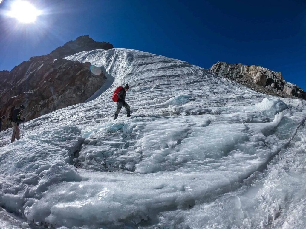
Cross the highest point of the trek, the Larkya La Pass, with unforgettable views of Himlung Himal and Annapurna II (19 km).
Distance: 19 km
Trek Duration: 8 hours
Sleeping altitude: Larke Pass: 5,106 m, Bimtang: 3,750 m
Descend through lush forests, terraced fields, and small villages to reach Gho (16 km).
Distance: 16 km
Trek Duration: 5 hours
Sleeping altitude: 1,963 m
A gentle trek to Dharapani, a gateway to the Annapurna Circuit (14 km).
Distance: 14 km
Trek Duration: 5 hours
Sleeping altitude: 1,860 m
Enjoy a scenic drive back to Kathmandu. Spend the evening shopping or exploring Thamel.
Distance: 200 km
Driving Duration: 9 hours
Sleeping altitude: 1,400 m
Transfer to Tribhuvan International Airport for your departure flight.
The following documents are required to kickstart your adventure with Yatri:
Original passport and a copy of the passport
Insurance is not mandatory for the normal trekking routes whereas, its mandatory in the regions which require special permit (Yatri provide insurance service by liasing with other insurance companies for your convinence).
You can obtain visa on arrival in Nepal or a visitor can apply for an e-visa. If you’re trekking in special permit regions, its important to apply visa approximately 5 days before your travel to Nepal and should be submitted to the Great Himalayan Yatri Pvt. Ltd.

Kirtipur
Kathmandu, Nepal
Mardi
Everest
Experience breathtaking treks through the Himalayas with our expert local guides.
Copyright © 2025 himalayan-yatri. All right reserved.